Python Open Street Map Assignment using Overpass
1. Use a PyPI module – successfully load and execute a query on OSM
2. Create at least 3 custom functions
getWaterFeatures(feats)
getBuildingFeatures(feats)
getPlacesOfLeiesure(feats)
3. For each of the above functions:
Iterate through features to count the features of each type:
[’Water’,’Building’,’Leisure’] and extract any feature that is named...
Should return a number and a list of names.
Takes as parameter the list of features from a bounding box.
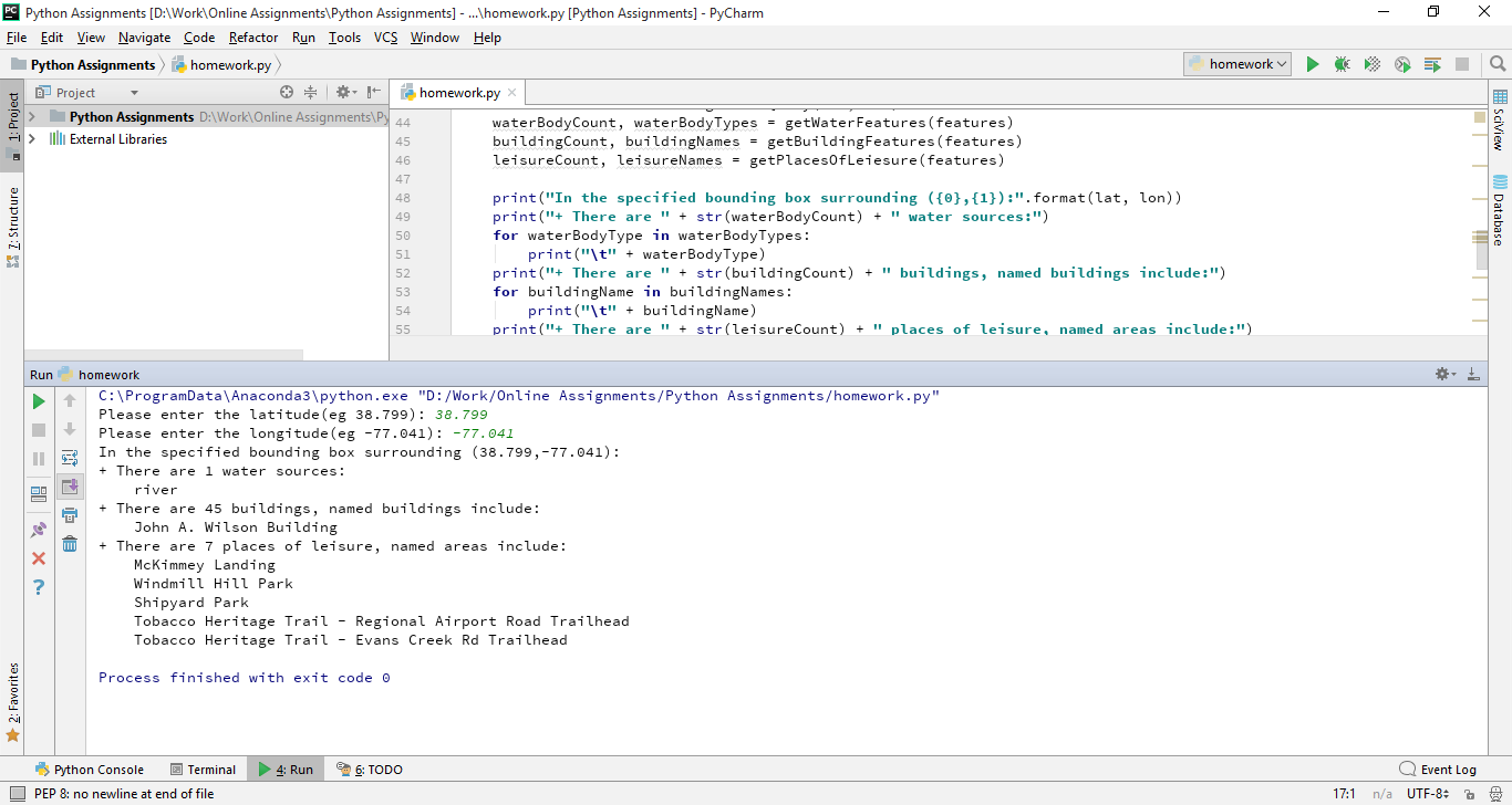
4. Put together a program that asks the user for a latitude and longitude. (how to input is up to you so long as the UI is clear)
5. Call overpass functions and your functions to provide appropriate output, and format it to match the examples at the end...
6. When calling MapQuery use a small bounding box (2 thousandths of a degree)
Need a custom answer at your budget?
This assignment has been answered 4 times in private sessions.
Or buy a ready solution below.
Buy ready solution
Solution previews